Last week, on the 19th anniversary of the tragic 911 attack, I shared my new Ground Zero Series, which was a collection of drawings that show what the 16-acre piece of land, where the twin towers once stood, looks like today. Here is the story behind it:
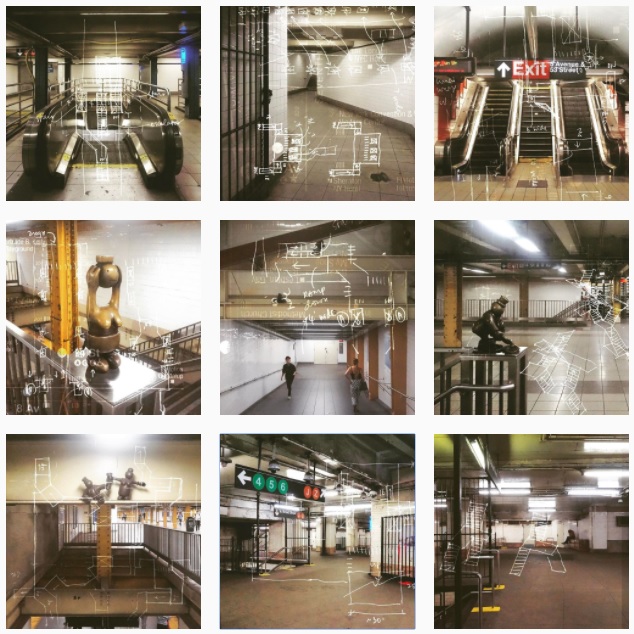
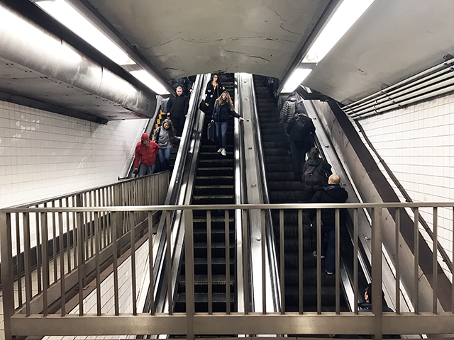
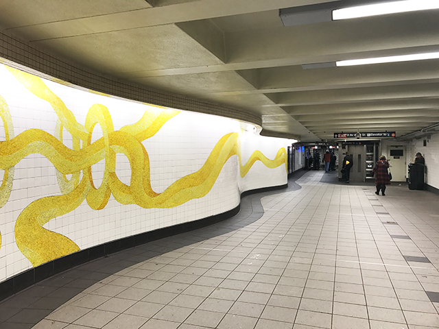
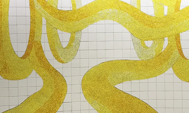
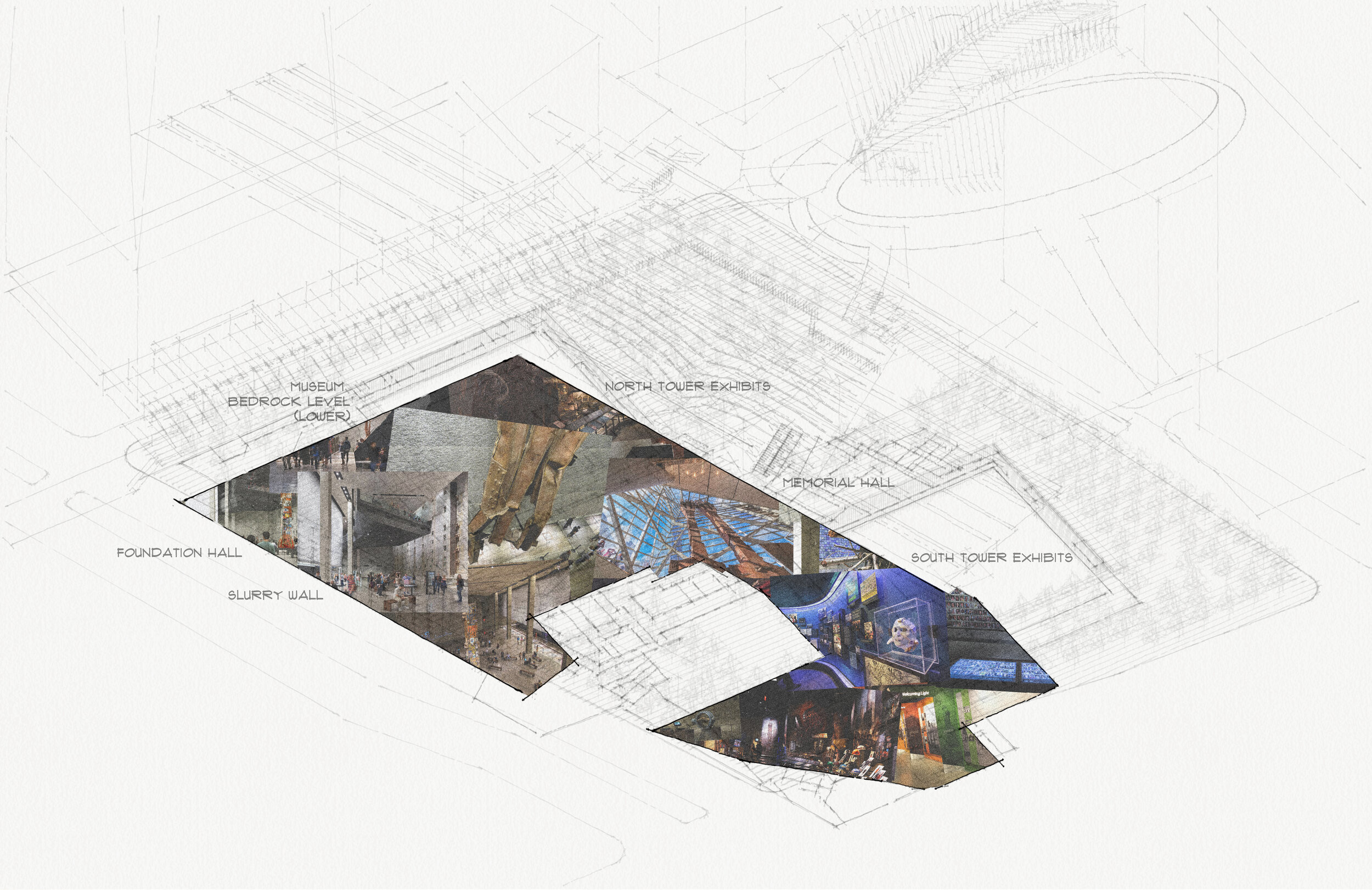
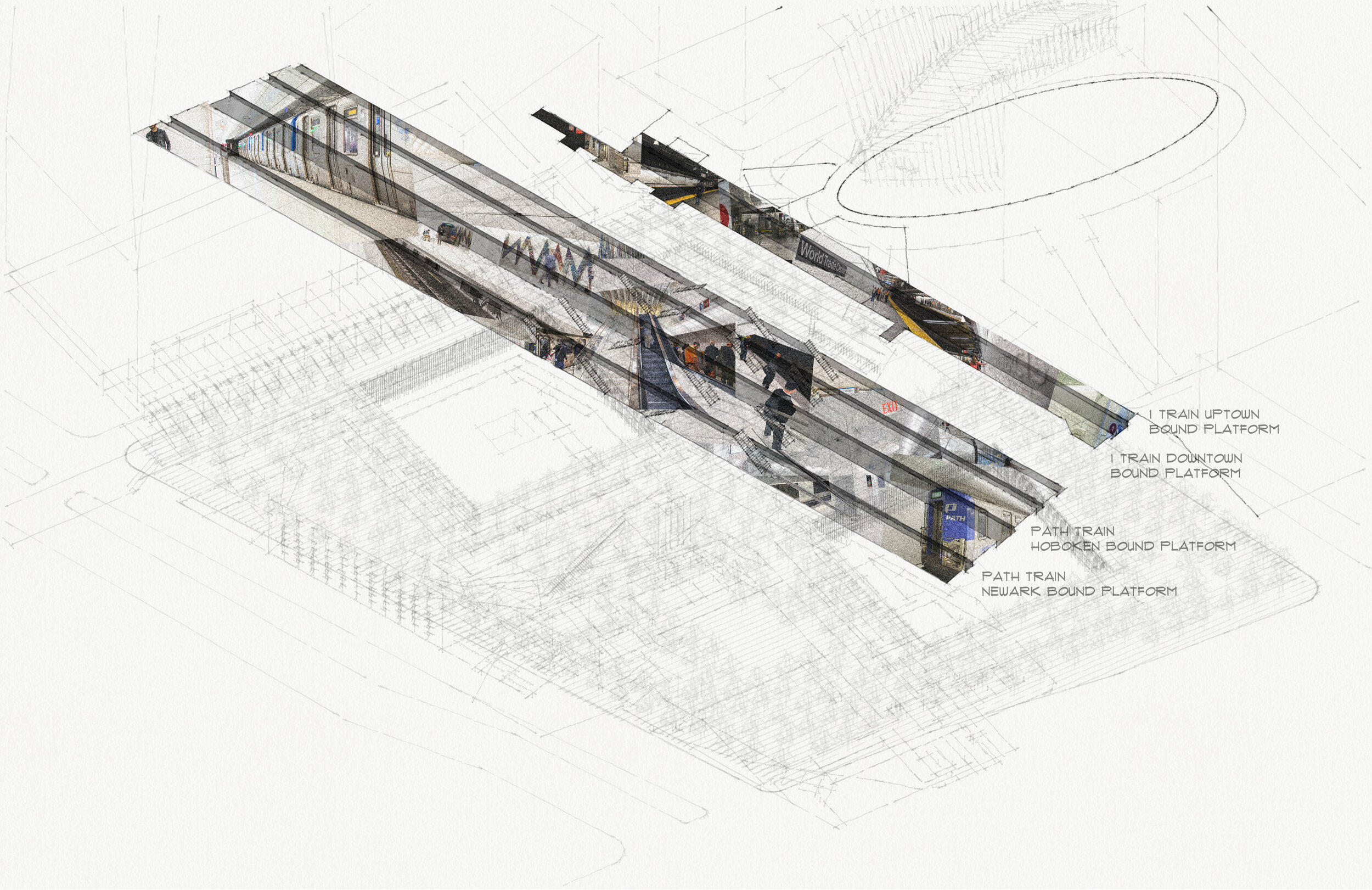
The first set, the Ground Zero Collages, was generated by the same axonometric view of the site, with different programs highlighted in each image. Even though these programs fit together tightly like Tetris pieces, each space has its own distinct character and atmosphere. And so I mapped each piece with photographs that capture the touch and feel of the space: The memorial park with lush greenery, the waterfalls the calming moving streams and cold grey stones; the museum the exhibits and dark solemnity, the Oculus the white marble, and the train platforms the escalators, signage and utility:


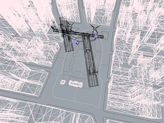
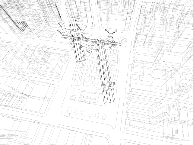
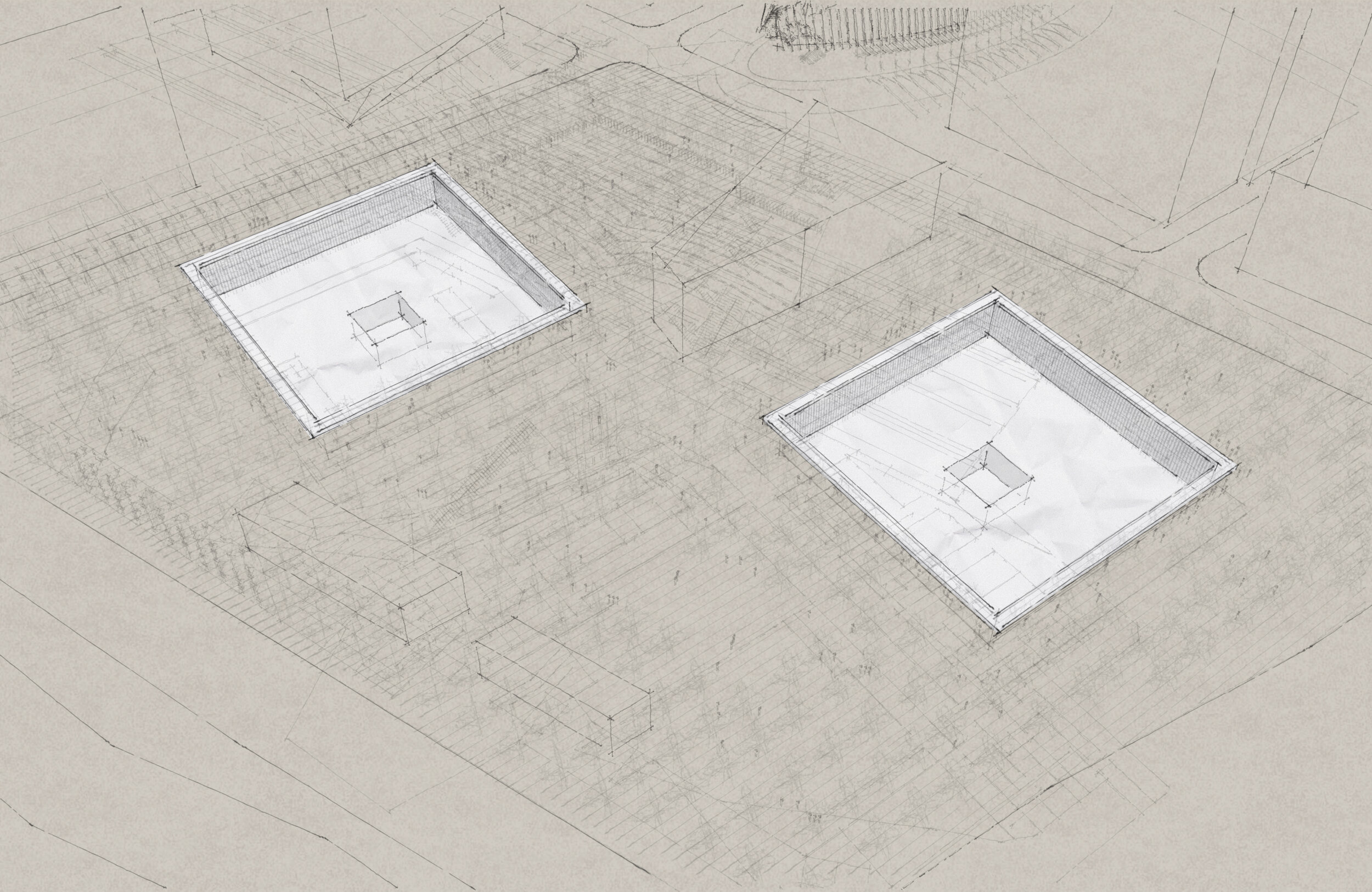
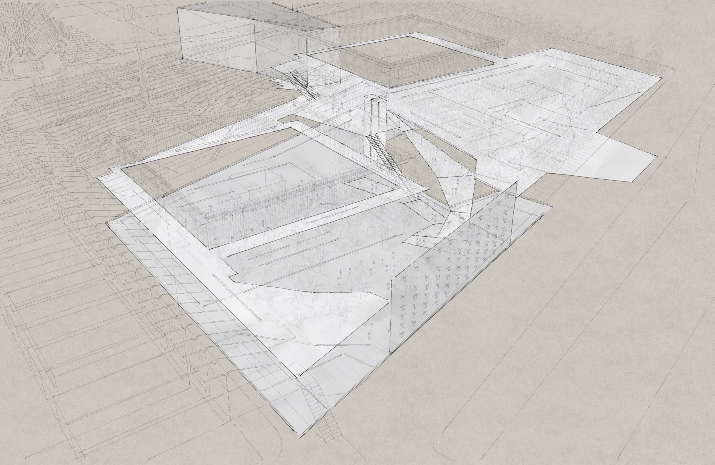
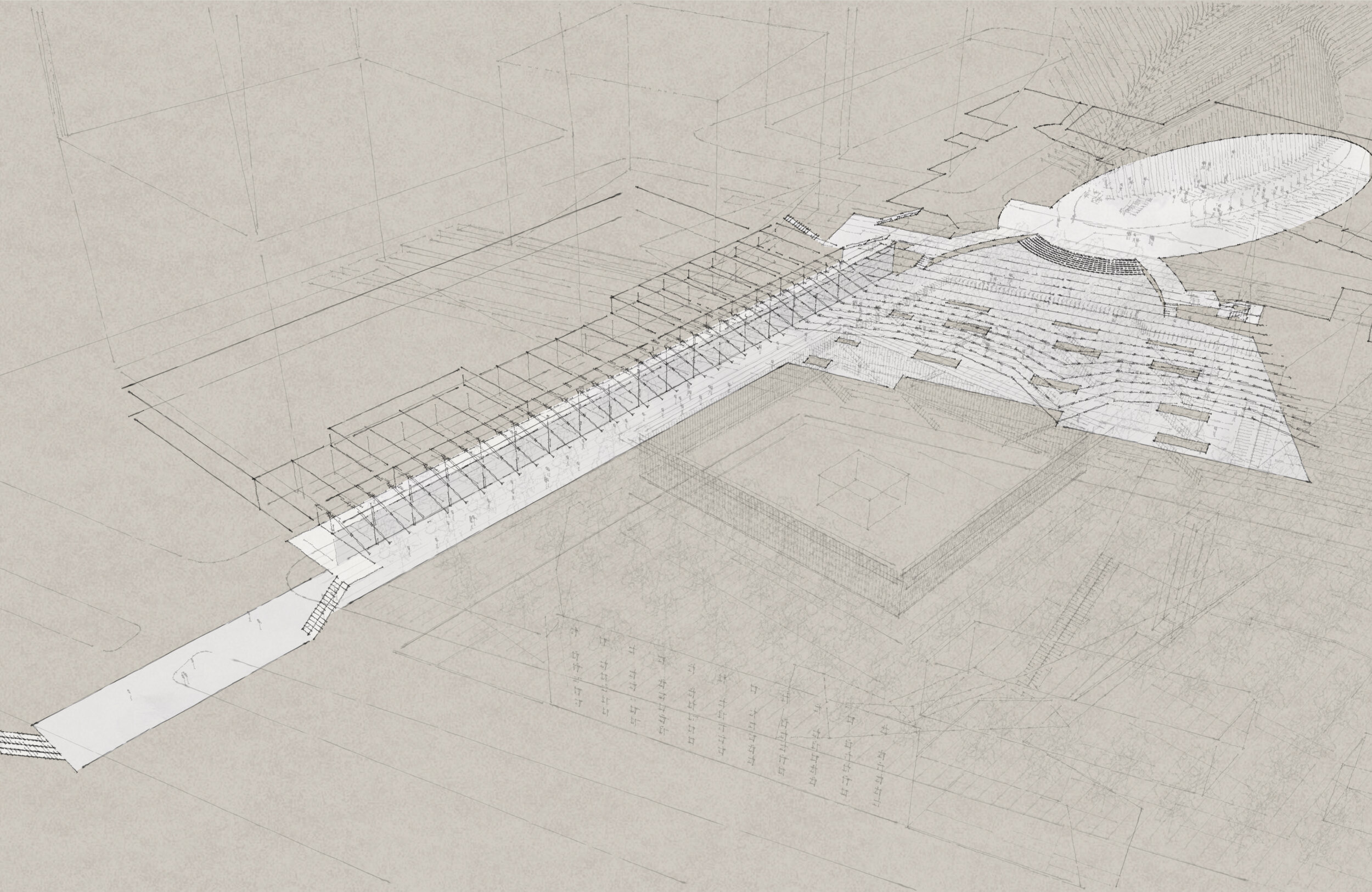
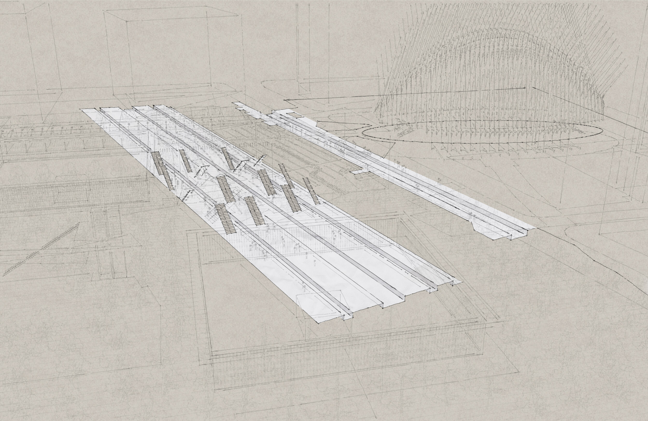
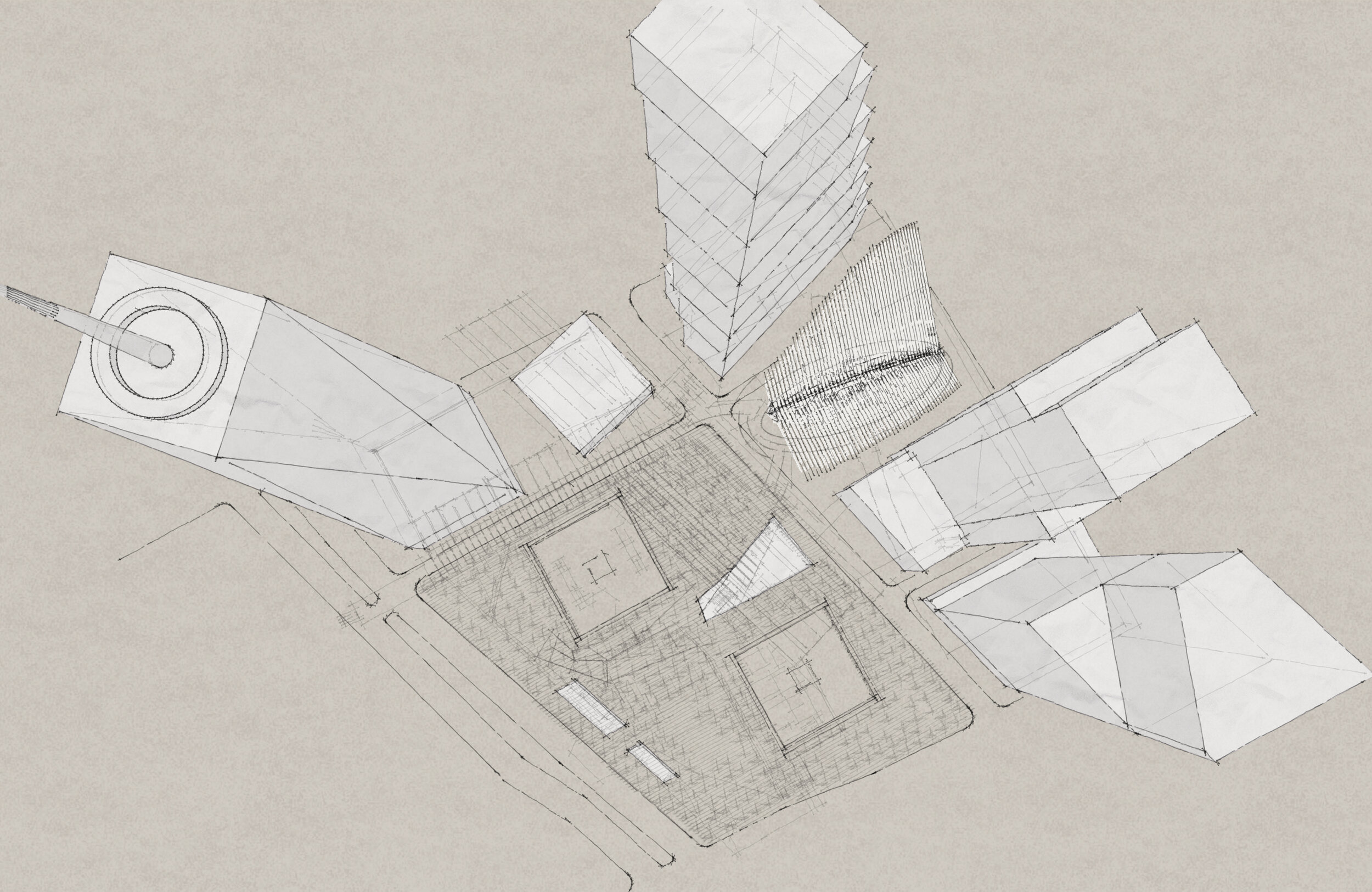
The second set, the Ground Zero Sketches, was generated by exporting different perspective views for each of the elements highlighted in white against a brown paper texture. In both series are these few key elements:
OVERVIEW (above ground): Freedom Tower (1 WTC), the Performing Arts Center (under construction), 2 WTC (under construction), the Oculus, 3 WTC, 4 WTC, and the World Trade Center Memorial Park and Museum which consists of the two pools, the memorial park, the Museum Entry Pavilion, and the West Vent Structure
WATERFALLS: The two square-shaped negatives (North Pool and South Pool)
MUSEUM: Entered through the entry pavilion, with the ribbon that hugs the south edge of the North Pool descending into to the underground exhibition space with the double-height slurry wall
OCULUS: The skeleton-looking structure designed by Santiago Calatrava with an oval atrium. Through the grand curved steps it is connected to the PATH train concourse and the linear West Concourse, which runs on the north of the North Pool and underneath Fulton Street. It leads to Brookfield place on the other side of the West Side Highway. You can also enter the Freedom Tower here.
PATH TRAIN AND SUBWAY (1 TRAIN): The 1 Train (WTC Cortlandt station) is one level above the Oculus’ oval atrium (train runs under Greenwich Street), and the PATH train (World Train Center station) is one level below the PATH train concourse.
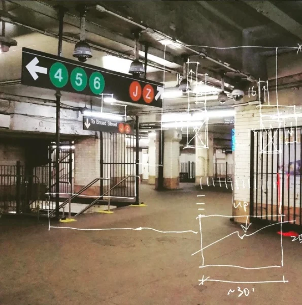
This site means a lot to me, because I actually worked on the museum when I worked for Davis Brody Bond when I first came to the US in 2007. I found this screen shot from that many years ago, on which a friend commented by saying “it really looks like a wound”:

“Wound” at Ground Zero, approx. from 2007
And I was lucky enough to be able to visit the site. These were taken from the lower level, where the slurry wall was exposed and the PATH train was running on a temporary structure:
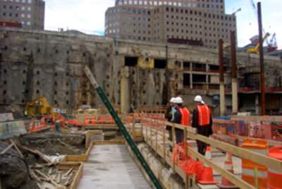
Slurry Wall at Ground Zero, NYC, 2007

PATH train at Ground Zero, NYC, 2007
Here are two books about the site, one about the politics and another one about Daniel Libeskind, the architect behind the original site plan. I loved and still own both, and would love to read them again some day:


Twelve years later, with my background in making 3d subway drawings, folks at the New York Review of Architecture (NYRA) reached out to me about making a drawing for their Sept 2019 issue. The assignment was to make a simple section, which should only cut through a few things; but in order to understand how things fit together, I thought I might as well build a 3D model.
There are actually a good number of drawings about each specific piece out there- the original site plan, museum floor plans, Oculus floor plans, and even some schematic sections are all a google search away:

Architectural drawings of the Ground Zero site found online
There just wasn’t one comprehensive drawing that shows everything at the same time, especially when it comes to things below ground. Here is my first attempt to sketch out the spatial relationships:
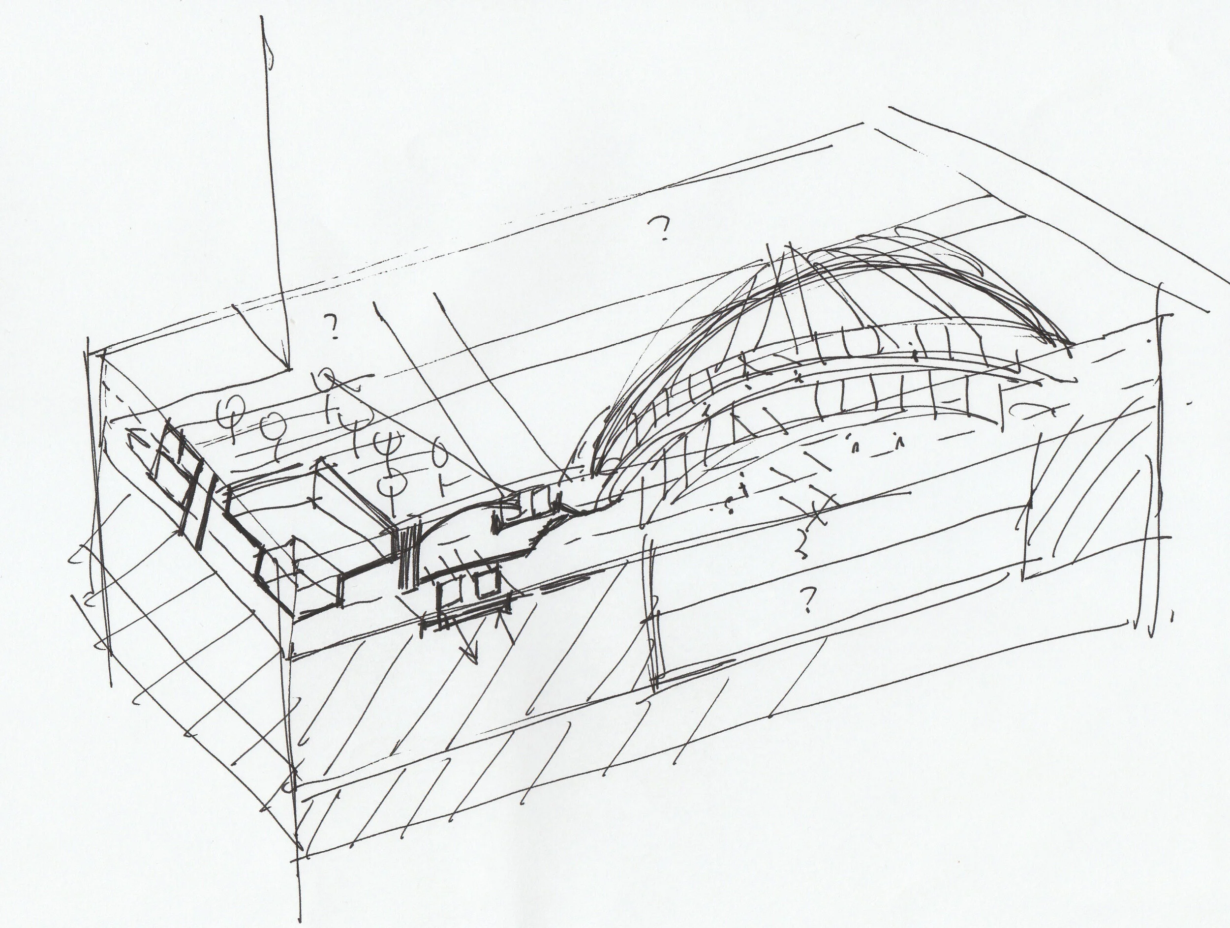
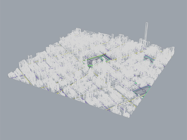
With a little detective and stitching work, I put together this 3D model in Sketchup:

Cutting halfway through the North Pool in this study perspective with human scale, you can see there are two levels of shops with structural ribs in the West Concourse, the North Pool next door, and the Oculus lookg like a bird in the background:

And from there and a little experimenting with Sketchup’s presentation styles, this was the final image that appeared on NYRA:

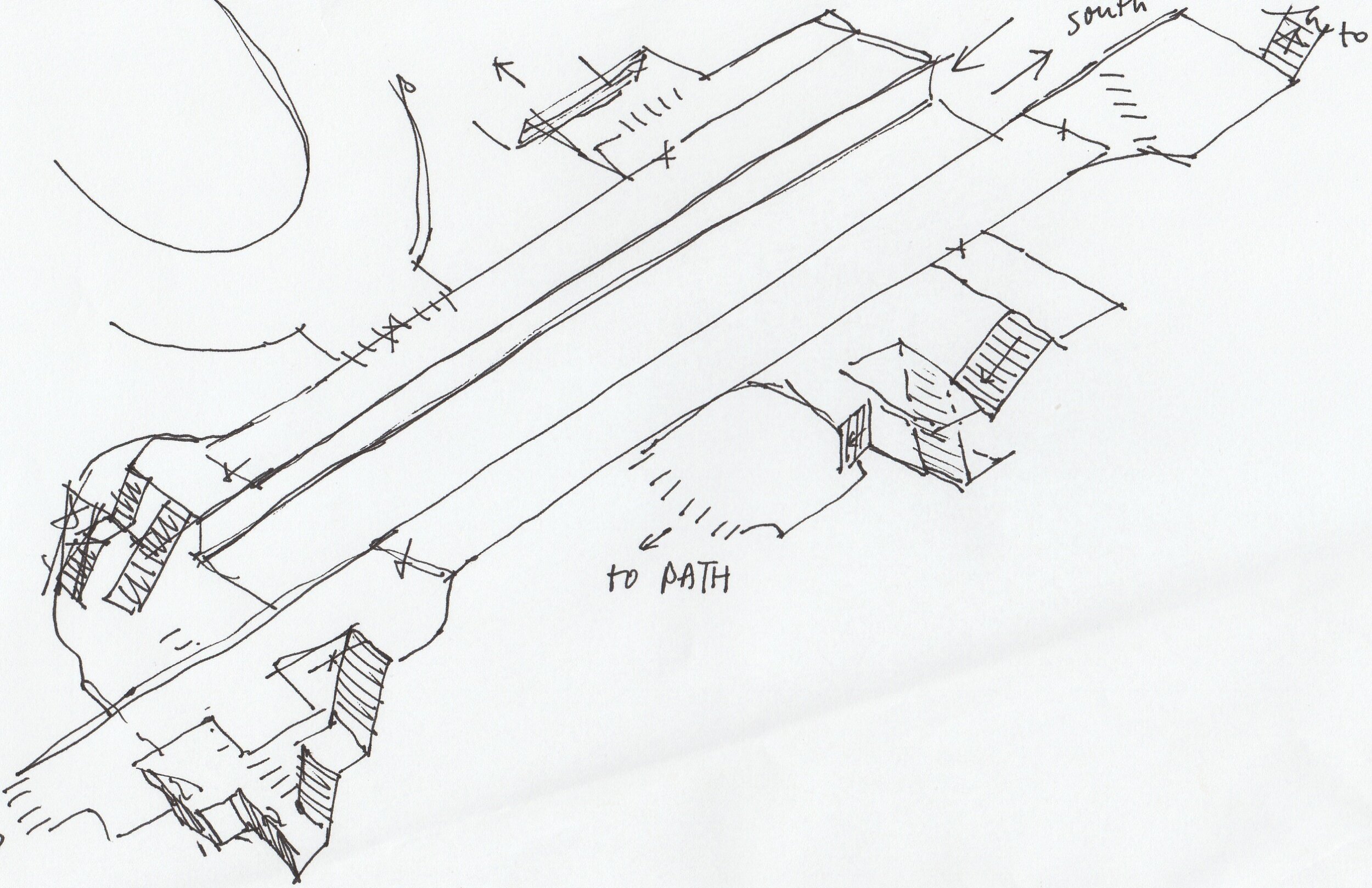
Since I already had the model, it was a waste not to have some fun and do more with it. Zooming back out to birds eye view, we get two sections like these:

Section through North Pool - Above Ground

Section through North Pool - Below Ground
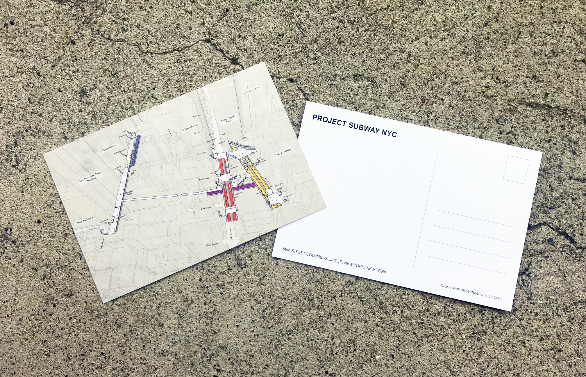
I eventually decided to go with the more sketchy style with pencil strokes in the final drawings. You can find the drawings in higher resolution in the Ground Zero page.
I am glad I found time during this pandemic to put this together, which helped me feel that at least some things have come full circle. Through the act of objectively piecing the puzzle together and subjectively presenting it in my own way, I had an odd satisfaction of having some sort of clarity, followed by a sense of control and peacefulness.
I can’t wait for this pandemic to be over so we can get back in action. Until then, stay safe, and wear a mask!