the grand central complex
Mapping the hidden layers of Grand Central Terminal, from the skyline to 150 feet below ground.
The hidden layers of Grand Central Terminal in the urban context
After years of subway studies — and many requests — I decided to take a crack at Grand Central Terminal, including the newly opened Grand Central Madison. Months of research (and a LOT of steps) went into this one! My original goal was to create that one definitive drawing worth a thousand words — a single image that would explain it all. But I soon realized that a complex of this scale demands more than one lens. Instead, I made this series of 10+ drawings each illustrating a few things at a time.
01- skyline & context
We’ll start with a bird’s-eye, axonometric view. On the outside, Grand Central Terminal is a monumental Beaux-Arts landmark with the towering MetLife Building directly behind it, flanked by Midtown icons like the Chrysler Building and One Vanderbilt.
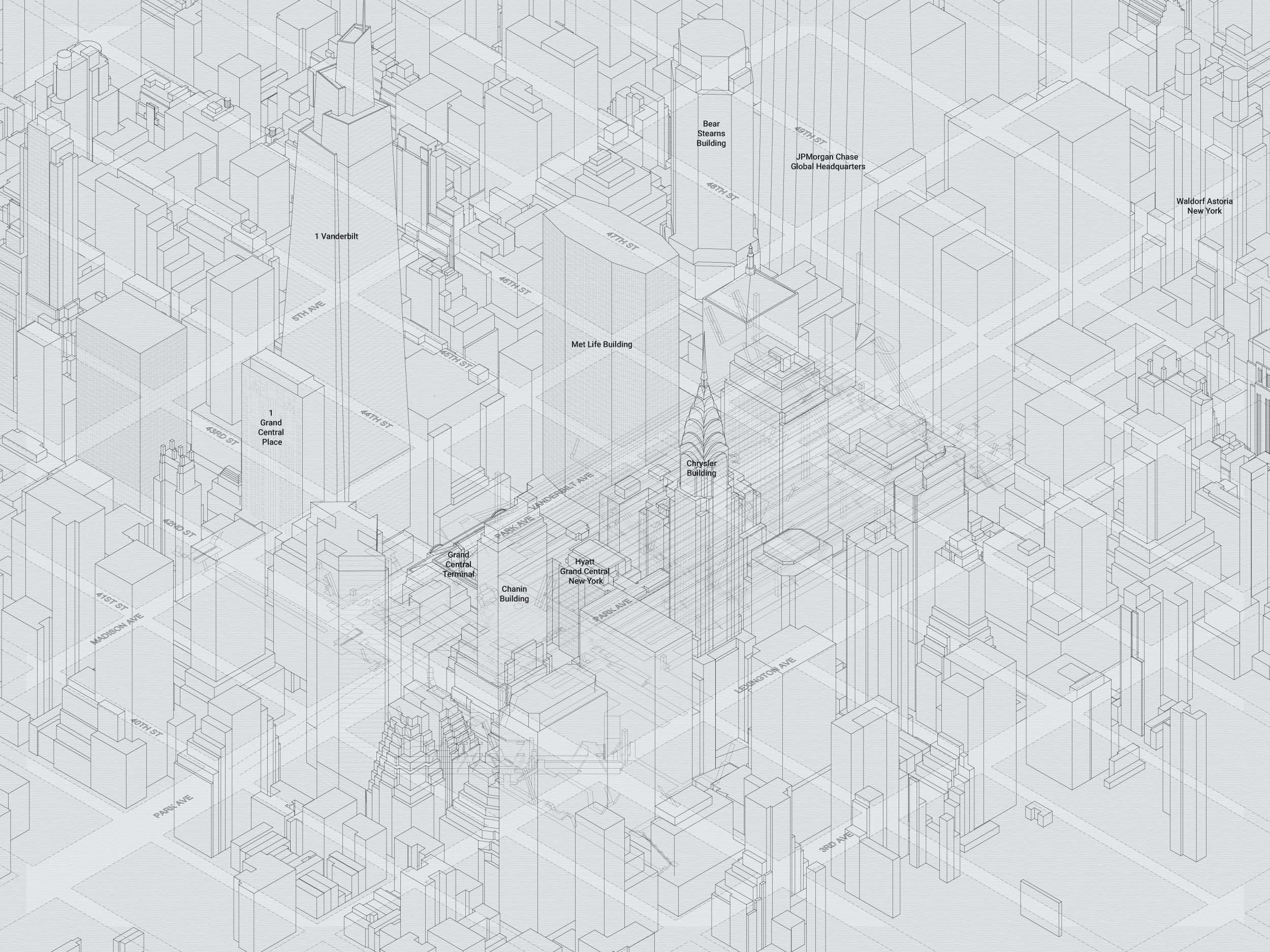
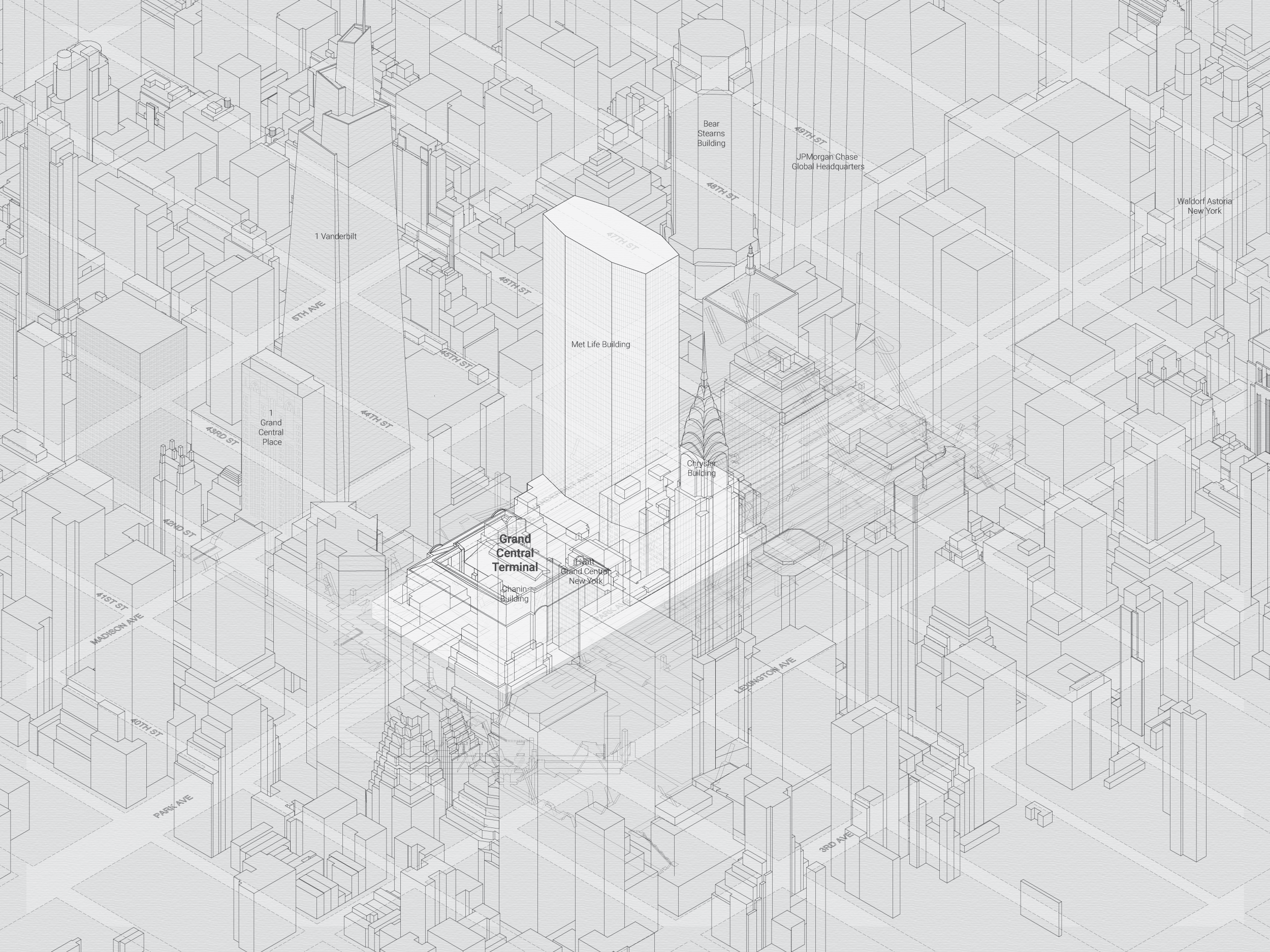
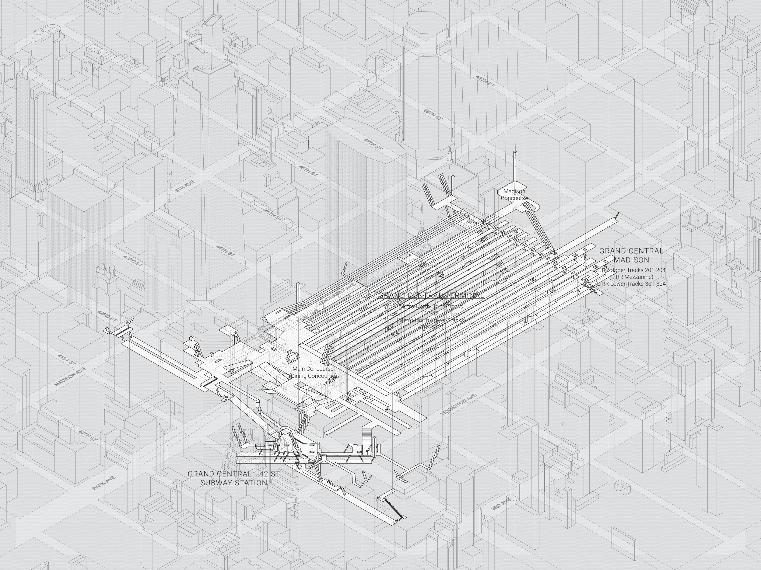
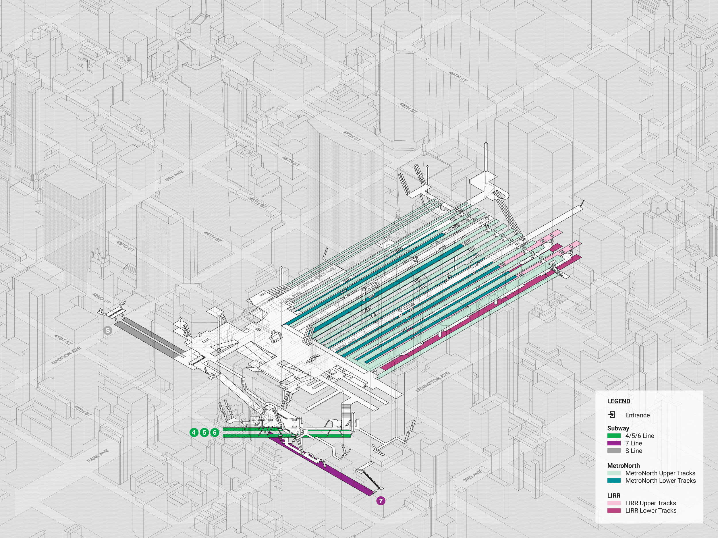
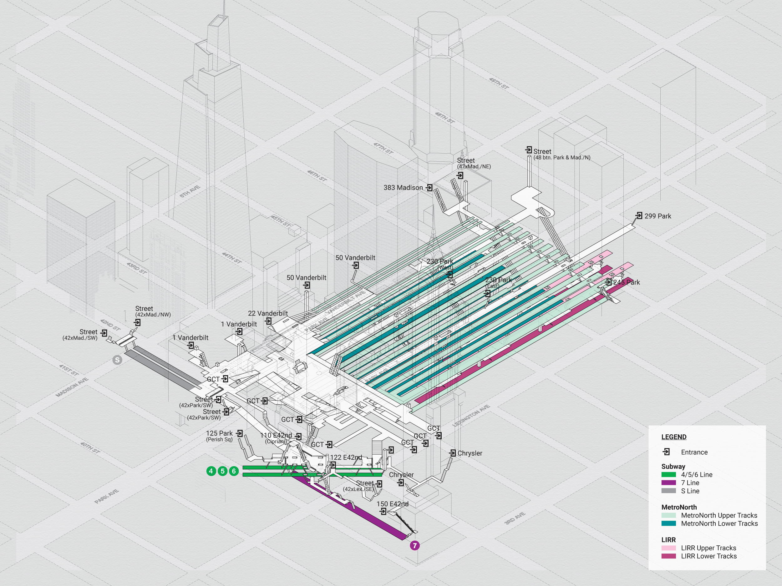
While “Grand Central” is most often associated with the main terminal building, its underground footprint spans from 42nd to 48th Street and Madison to 3rd Avenue, featuring nearly 30 ground-level access points. On and below street level is a vast world of retail, dining concourses, and three major transit networks: the MTA subway station (4/5/6/7/S), Metro-North Railroad, and the Long Island Rail Road (LIRR) at Grand Central Madison.
02 - Subterranean organization & Spatial Depth
The Grand Central Complex’s underground infrastructure, viewed from Southeast
Peeling away the surface reveals a dense, multi-level world beneath the streets.
The vertical scale is exaggerated 4x to make the relationships between underground levels easier to see. The drawings use two color schemes to explore the complex from different perspectives: one separates the subway, Metro-North, and LIRR networks; the other uses a heat map to show depth relative to street level.
The Grand Central Complex’s underground infrastructure, viewed from Southeast, color coded by transit network
The Grand Central Complex’s underground infrastructure, viewed from Southeast, color coded by depth from street
The Grand Central Complex’s underground infrastructure, viewed from Northeast
The Grand Central Complex’s underground infrastructure, viewed from Northeast, color coded by transit network
03 - the larger picture
Zooming back out, we can see how the pieces fit together across three avenues and seven streets.
The Grand Central Complex’s underground infrastructure, viewed from the top
The Grand Central Complex’s underground infrastructure, viewed from the top, color coded by depth from street
04 - Explore for yourself
Explore the complex in three dimensions with this navigable model. You can also download it here.
[Visit the Project Subway NYC shop]
05 - disclaimer, references & resources
As always, I am not affiliated with the MTA or any official transit agency. All drawings were created from scratch based on my own field research and architectural documentation.
If you are interested in exploring further, here are the primary resources I referenced: