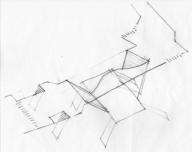
I started sketching the Broadway - Lafayette station - didn't realize even though the subway lines are straight, some mezzanine openings are curved!


W TRAIN!
The W train has been back in service since November this year and I finally found the time to update my graphics accordingly. R and W run local on the outside while N and Q run express on the inside. Check them out in our Shop page!

Times Square N / Q / R / W lines
Apply discount code BYE2016 for 15% off on all orders.
HAPPY HOLIDAYS!
2016 had been an incredible year for Project Subway NYC, as I continued my effort to map out and draw more stations, I have also been blessed with opportunities to present, write, and discuss ideas from urban infrastructures, to architecture, to data visualization, and more. Thank you all for being part of this journey! I know I have not been super consistent with updating the site but rest assured I will keep moving forward with the project. I look forward to an exciting and fun 2017!
Here's a subway-station-looking Christmas tree. Merry Christmas and best wishes for a happy new year to you all!
-Candy

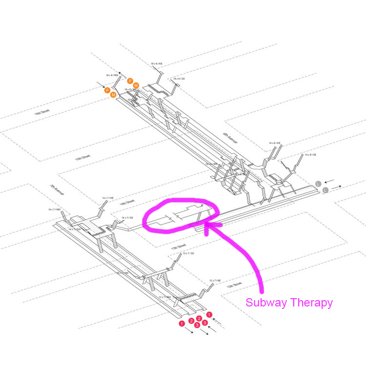
SUBWAY THERAPY
As some New Yorkers mourn, and some celebrate, president elect Trump's victory, subway "therapist" Levee has created a colorful installation with post-its and invite people to write whatever they feel like. The installation is located in the tunnel between the F/M/L line (6th Ave) and the 1/2/3 line (7th Ave), on 14th Street:
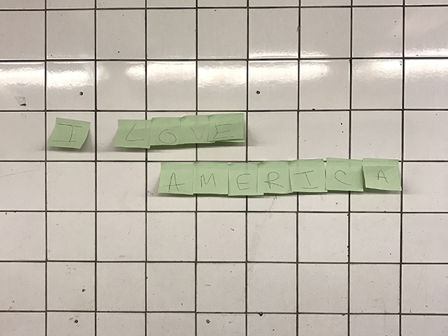
"I LOVE AMERICA"

Tunnel between 6th and 7th Avenue on 14th Street

New Yorker writing down their thoughts after the election
This is a perfect example of utilizing the un-programmed spaces in the stations to create experience for the community. For more information, visit subwaytherapy.com
on data
Ever realize there are numbers on the turnstiles?!!

Turnstile at Columbus Circle Station
14TH STREET - 6TH AVENUE AND 7TH AVENUE (1/2/3/F/M/L)
This station has sooooo many entrances, 19 to be exact!

14th Street - 6th Ave and 7th Ave Neighborhood Map


( And I just realized there is "FML" in the station name...haha.)
ON ORANGE AND BLUE
It's interesting how some color schemes have such strong identities. When I look at each station and the combination of colored lines that pass through them, I will draw connection to random things..
For example, are you a Knicks or Mets fan? Two of my new prints happen to be blue and orange:


Actually, the West 4th Street station also has the same colors. Would make for a good color scheme of your room. Check them out along with a few other new prints in our shop page!
OCR Friday next week (6/24)
Thrilled to present at the Office for Creative Research (OCR) next Friday (6/24). The format is like a mini-TED talk, with 30-40mins presentation + a brief Q&A session. And there will be free beer! My last presentation at Parsons was primarily about the relationship between subway systems and retail, but this time is just about the project itself and its development over the past year.
RSVP here if you are interested! :
14TH STREET STATION (A / C / E / L) - CONT'D
More Sketches
7th AVENUE STATION (B / D / E)
Sketching in midtown on a relaxing night..
A little observation - the same configuration is repeated on 53rd street, which makes a nice, clean and linear station!
14th STREET STATION (A / C / E / L)
Back to the grind finally!
14th Street Station at A / C / E / L line - Sketch 1
14th Street Station at A / C / E / L line - Sketch 2
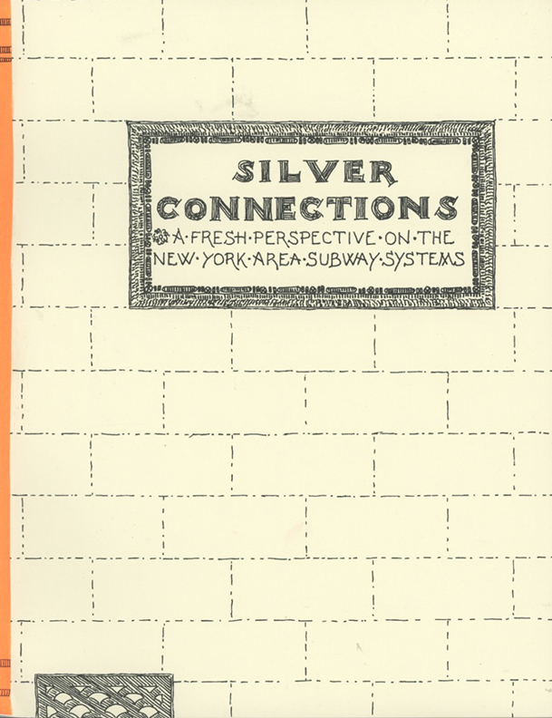
SILVER CONNECTIONS
When I started Project Subway NYC, I did a (maybe not so thorough) search on the internet to see if anyone has attempted to do something similar. I don’t know how this escaped me, but recently I came across this clip from “Great Big Story”:
Philip Coppola has been drawing and documenting New York City’s subway system, one station at a time, since 1978. He has since published four books in a series called “Silver Connections”, which are available on newyorkboundbooks.com:
Silver Connections Volume I

Silver Connections Volume III
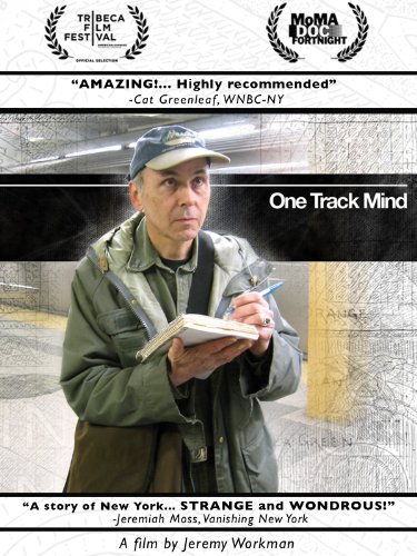
Mr. Coppola’s quest did get some press, but the reason that it does not get more attention, has probably to do with the fact that he tries to keep a very low profile. Luckily and coincidentally, two weeks ago there was a screening of the documentary about him, by director Jeremy Workman, and so I got to see him speak. I went and I enjoyed the film as well as the Q&A session a lot. Mr. Coppola talked about his process and methods, and the audience discussed both the scholarly and eccentric side of him.

Philip Coppola and Director Jeremy Workman
The film, called “One Track Mind”, is 30-minute long and is available on Amazon:
IT'S A WRAP!
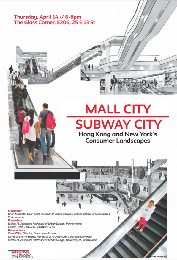
Two weeks ago I presented at Parsons at the "Mall City / Subway City" event, which was a celebration of Professor Stefan Al's forthcoming book < Mall City >, and an interesting discussion about the idea of Asian urban malls as extensions of mass transit systems coming to New York.
A lot of questions were raised: Are malls public spaces? Are malls just bringing the suburban life into the city? Can small businesses survive in malls? Where is the demand coming from? The concept works in Hong Kong, will it work in NYC?
Project Subway NYC started by being a simple drawing exercise, but I am pleasantly surprised by how it is slowly turning into a basis for an examination and exploration of this networked system which has economic, social, and cultural impact on the city. Now I am even more excited and motivated to keep going!

Panel Discussion (Left to Right - Brian McGrath, Carol Willis, David Grahame Shane, me, Stefan Al)

Presentation
A belated big thank-you to all of you who made it to the event. It was a fun and rewarding experience in itself, but being able to share with my own friends and colleagues made it all the more meaningful and encouraging.
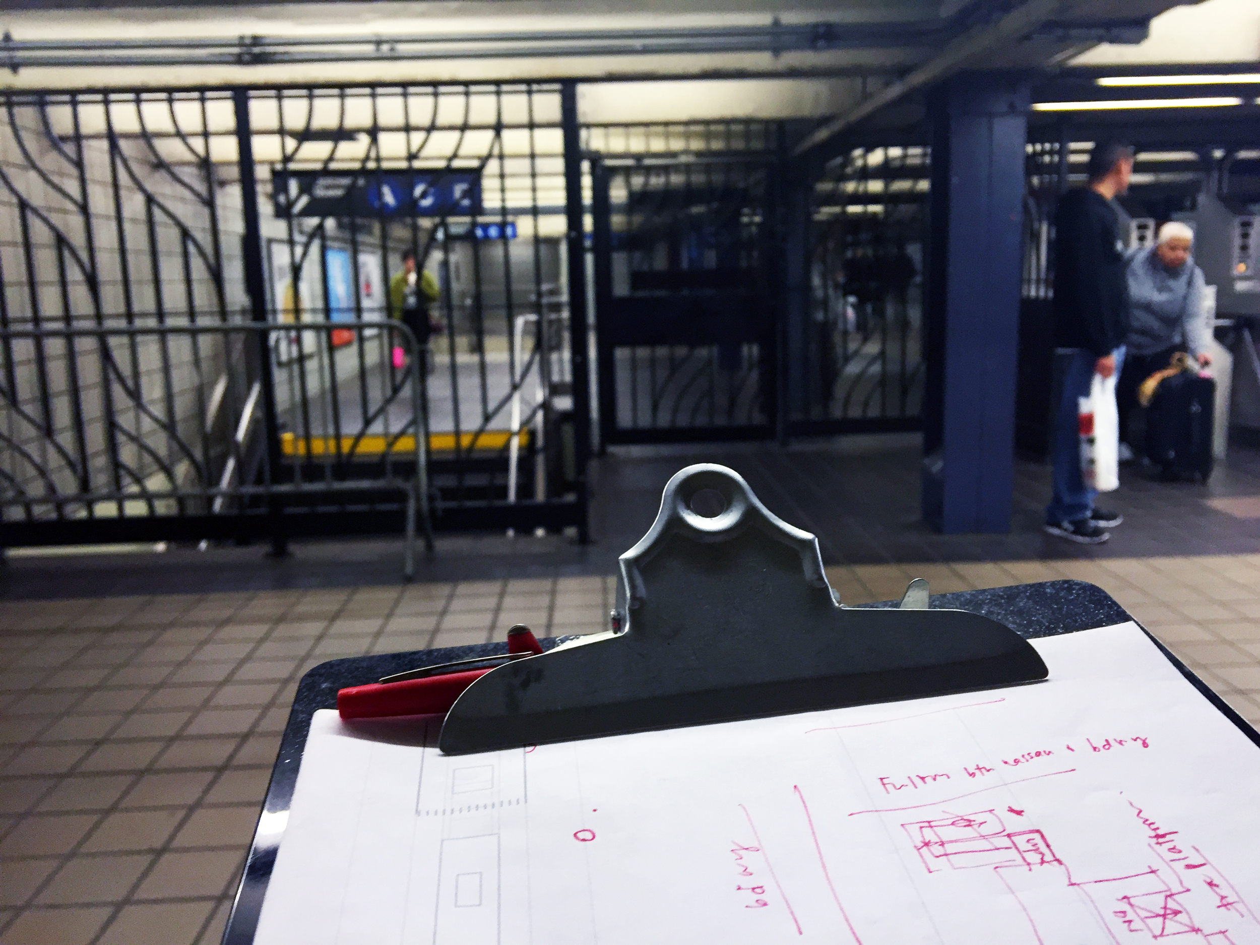
I have stopped producing drawings since November - between then and now I have made a competition entry (with a subway-themed fairy tale), went back to Hong Kong for two weeks, prepared for this "Mall City / Subway City" presentation, and most importantly regrouped my thoughts and vision about where I want Project Subway NYC to go. Now that it's finally getting a bit warmer, it's time for me to get my clipboard ready and get back in action!
HOW TO GET TO PARSONS EAST BUILDING
The lecture tonight is going to be at the Parsons East Building, at 25 East 13th Street. The nearest subway station is the 14th Street Union Square station. If you are taking the subway, check this out:
I know it's a little messy and hard to read, but basically,
if you are taking the L train, walk all the way west;
if you are taking NQR, walk all the way south; and
if you are taking 456, walk north on the platform, then walk all the way west.
Here is Google Map:
Hope to see you all!
MALL CITY / SUBWAY CITY PRESENTATION
I am really thrilled and honored to be invited to do a presentation at Parsons next Thursday, at 6pm. Afterwards I will join a panel discussion with Stefan Al, Carol Wlllis, and David Grahame Shane, moderated by professor Brian McGrath. It will be about malls, subway systems, and consumerism. If you are interested, RSVP at this link. Will be great to see you there!
STATION FOOTPRINTS IN APPLE MAP
For the longest time, subway stations were represented by a singular symbol "M" on most map apps. I just realized recently that since iOS 9, apple map has been showing the footprints of the stations in faint pink, and individual exits in little orange dots, like in this screen shot:

Even though these are 2-D, this additional layer of information is in line with the goal of Project Subway NYC, which is to understand the subway stations not as a single point in space, but as part of a network that branches to various destinations in the city. So now if you have an iphone, you don't have to rely on MTA's neighborhood maps alone. Pretty neat, pretty neat!
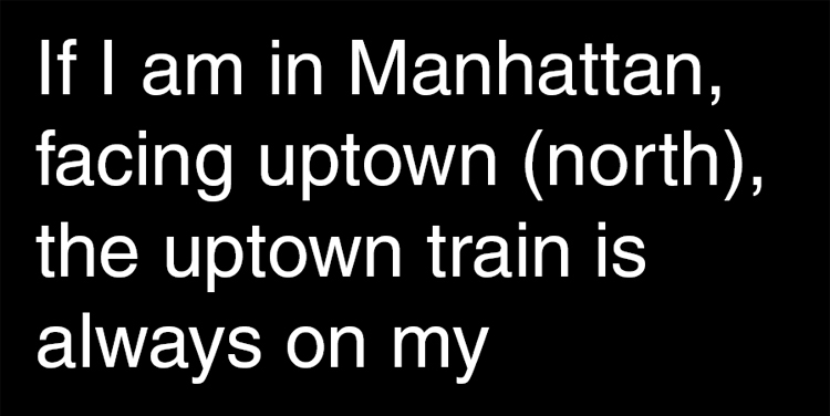
"UPRIGHT"
I am a big fan of rules of thumb - anything that dumbs down complex systems into bite size phrases one can easily remember and apply.
Not sure if it is obvious to everyone but one thing I realized when I'm doing this project is that "When I am in Manhattan, facing uptown (north), the uptown train is always on my right". And I thought, you can just remember the word "UPRIGHT". I hope a gif like this will help too:
CAN I DO THIS?
Since I launched this project last year, many people have asked me the same question: Can you actually do that? As in, can you just walk around in the subway stations and draw the layouts? I have to admit I only assumed it was okay, but in hindsight I shouldn't have assumed anything. So as I resume my drawing drill, let's take a moment to review the MTA's rules of conduct here:
As far as I can tell, there are only two sections that could potentially have something to do with surveying and drawing:
Section 1050.7 - Disorderly conduct
Can't find anything in this section; andSection 1050.9 - Restricted areas and activities
The only provision I find relevant is this:
(c) Photography, filming or video recording in any facility or conveyance is permitted except that ancillary equipment such as lights, reflectors or tripods may not be used. Members of the press holding valid identification issued by the New York City Police Department are hereby authorized to use necessary ancillary equipment. All photographic activity must be conducted in accordance with the provisions of this Part.
So, if I understood the rules correctly, as long as I do not use flash when I take my photos, and do not create any trouble, or cause any disturbance or interference to the operation of the train system, I should be fine.
This is a project I really want to continue to develop, and the last thing I want is to get into trouble. If you think I missed anything, please drop me a comment, thanks!
SUBWAY STATIONS IN VIDEO GAMES
I have been introduced to the world of video games recently, and I happen to know today is the big launch of this game called "Tom Clancy's The Division"- a game that takes place in a doomsdayesque / apocalyptic New York City. The game features a highly detailed NYC - streets, shops, landmarks... and subway stations! Here are some of the images and clips I found online:

(image source: http://www.gamepur.com/)
One of the video shows a "14th Street" station (not sure which one) and another one shows "Penn Station". I wonder how accurate they are - are they made up or did someone already go through the same exercise I did, scoping out every station? If they are accurate, maybe I can make my next batch of drawings by "surveying" inside this virtual reality...